In the tapestry of Earth’s geological history, earthquakes are a stark reminder of the dynamic and often unpredictable nature of our planet. These seismic events, from barely perceptible tremors to catastrophic upheavals, have fascinated and frightened humanity throughout the ages.
Among these, the largest earthquakes ever recorded not only reshaped the landscape but also left indelible marks on the societies they affected, spurring advances in science, technology, and natural disaster prevention. In this article, we’ll explore the 10 biggest earthquakes in history, delving into the stories of strength and resilience they weave.
10 – Assam-Tibet, 1950: Magnitude 8.6
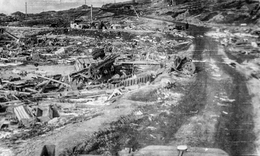
The 1950 Assam-Tibet earthquake, occurring on August 15, stands as one of the largest and most devastating seismic events of the 20th century, registering a magnitude of 8.6 on the Richter scale.
This colossal earthquake’s epicenter was located in the rugged terrains near Rima, in what is now part of the Tibet Autonomous Region of China, but its effects were profoundly felt across regions, most notably in Assam, India.
The Assam-Tibet earthquake was characterized by its extensive impact zone, affecting thousands of square miles of terrain. The seismic waves it unleashed caused widespread destruction, particularly in Assam, where entire villages were flattened, and critical infrastructure like bridges, roads, and railways suffered extensive damage, significantly disrupting daily life and hindering relief efforts.
One of the most catastrophic outcomes of this earthquake was the massive landslides it triggered. These landslides not only altered the region’s topography but also blocked rivers, creating natural dams. Eventually, these dams burst, leading to devastating floods that added to the already considerable toll on human lives and property.
The seismic event profoundly influenced scientific understanding and earthquake preparedness strategies. It prompted geologists and seismologists to study the unique geological features of the Himalayan region, deepening their understanding of the tectonic activities that characterize this area. The Assam-Tibet earthquake highlighted the need for improved earthquake-resistant construction practices, especially in regions prone to seismic activity.
In terms of human cost, the earthquake and its subsequent disasters led to the loss of thousands of lives, though the exact number remains uncertain due to the remote and inaccessible nature of many affected areas. The earthquake also resulted in a significant displacement of populations, as many were forced to leave their destroyed homes in search of safety.
The 1950 Assam-Tibet earthquake remains a poignant reminder of the dynamic and often unpredictable nature of the Earth. It underscores the importance of continuous research and innovation in the field of earthquake engineering and disaster management to mitigate the impacts of such catastrophic events in the future. Through studying historic seismic events like this one, we gain invaluable insights into preparing for and responding to the earthquakes that will inevitably occur in the future.
9 – Northern Sumatra, Indonesia, 2005: Magnitude 8.6
The 2005 Northern Sumatra earthquake, which struck off the west coast of Northern Sumatra, Indonesia, on March 28, is a significant seismic event that continues to captivate the interest of the scientific community for its intensity and implications on earthquake research. With a magnitude of 8.6, this earthquake is among the strongest quakes recorded since the advent of modern seismic monitoring technologies.
This seismic event occurred along the same fault line that had unleashed the devastating 2004 Indian Ocean earthquake and tsunami just months earlier. The 2005 quake, however, did not generate a large tsunami, primarily due to the nature of the seabed movements involved.
Unlike the 2004 event, which involved a massive vertical displacement of the ocean floor, the 2005 quake primarily resulted from a horizontal sliding of the earth’s plates, a movement type less likely to displace large volumes of water and thus less likely to generate a tsunami of significant height.
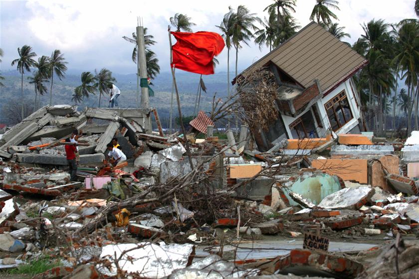
The Northern Sumatra earthquake of 2005 deeply impacted the already reeling region, exacerbating the challenges of recovery from the previous year’s tsunami. It caused significant structural damage in Northern Sumatra, including the Nias Island, where the effects were most pronounced. Buildings, roads, and bridges suffered considerable damage, complicating efforts to rebuild after the 2004 tsunami’s devastation.
This event underscored the complex and dynamic nature of the earth’s tectonic movements, particularly in the region of the Sunda Trench, where the Indo-Australian Plate subducts beneath the Eurasian Plate. It provided a stark reminder of the seismic hazards facing communities living in proximity to this volatile convergent boundary.
The scientific community has meticulously analyzed the 2005 Northern Sumatra earthquake, gaining insights into the mechanics of mega-thrust earthquakes and the potential for subsequent seismic activity along fault lines already strained by previous events.
This earthquake has contributed to refining models of seismic risk and improving earthquake prediction techniques, highlighting the importance of ongoing research in understanding and mitigating the impacts of seismic disasters.
In terms of human and economic costs, the 2005 quake led to hundreds of fatalities and significant property loss, further straining the resources of a region still in the throes of recovery from the catastrophic events of the previous year.
8 – Rat Islands, Alaska, 1965: Magnitude 8.7
The Rat Islands, a part of the Aleutian Islands in Alaska, were the epicenter of a powerful earthquake on February 4, 1965. This seismic event, with a magnitude of 8.7, stands out as one of the most potent earthquakes in the United States’ history, showcasing the immense tectonic forces at play along the Pacific Ring of Fire.
The 1965 Rat Islands earthquake was a result of the Pacific Plate subducting beneath the North American Plate, a process that characterizes the seismic activity in this region. The earthquake occurred deep within the Earth’s crust, generating a series of strong tremors felt across the Rat Islands and beyond. Despite the earthquake’s magnitude, the remote location and sparse population of the affected area meant that damage to human-made structures was minimal. However, the natural environment experienced significant alterations, including landslides and a noticeable change in the coastline of some islands in the vicinity, highlighting the raw power of tectonic movements.
One of the most significant outcomes of this earthquake was the generation of a tsunami. Although the tsunami waves were relatively small by the time they reached the inhabited areas of Hawaii and other parts of the Pacific, they were sufficiently large in the immediate vicinity of the epicenter to cause notable changes in the landscape. The event provided valuable data for the study of tsunamis, contributing to the understanding of how underwater earthquakes can trigger these powerful sea waves.
The Rat Islands earthquake of 1965 played a crucial role in advancing the scientific community’s understanding of seismic and tsunami risks associated with major subduction zones. This event, along with others in the seismically active Pacific region, has informed the development of more sophisticated models for predicting the behavior of earthquakes and tsunamis. Such models are critical for improving preparedness and mitigating the impacts of future seismic events on vulnerable communities.
Moreover, this earthquake underscored the importance of international cooperation in the monitoring and sharing of seismic data. The global nature of the tsunami threat, with waves capable of traveling vast distances across ocean basins, highlighted the need for a coordinated global response to seismic events. This has led to the strengthening of international seismic and tsunami warning networks, enhancing the capacity to warn populations of impending danger.
7 – Off the Coast of Ecuador, 1906: Magnitude 8.8
The 1906 earthquake off the coast of Ecuador is a historic seismic event that underscores the volatile nature of the Earth’s tectonic activities, particularly along the boundary of the Nazca and South American plates. Occurring on January 31, 1906, this earthquake, with a magnitude estimated to be between 8.8 and 8.9, is one of the strongest and most devastating earthquakes in the history of South America.
The epicenter of this colossal earthquake was located in the Pacific Ocean, just off the coast of Ecuador and Colombia, in a region known for its complex tectonic interactions. The event was caused by the subduction of the Nazca Plate beneath the South American Plate, a process that generates significant geological stress and has the potential to unleash powerful earthquakes.
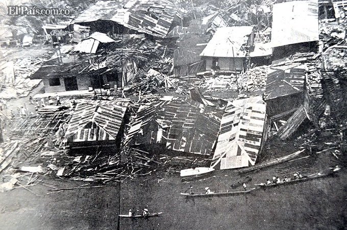
The 1906 earthquake had profound impacts both on land and in the ocean. Along the coastlines of Ecuador and Colombia, entire communities were devastated. Buildings collapsed, infrastructures such as roads and railways were destroyed, and many lives were lost. The cities of Esmeraldas in Ecuador and Tumaco in Colombia were among the hardest hit, suffering extensive damage that highlighted the vulnerability of human settlements to the Earth’s natural forces.
One of the most significant effects of this earthquake was the massive tsunami it triggered. The sea waves generated by the seismic event reached as far as Hawaii, Japan, and the San Francisco Bay area, demonstrating the far-reaching impact of major seismic events. The tsunami caused additional destruction and loss of life along the Pacific coastline, adding to the disaster’s overall toll.
The 1906 earthquake and its ensuing tsunami were pivotal in advancing our understanding of the Earth’s seismic behavior. This event contributed to the early body of evidence supporting the theory of plate tectonics, a framework that has revolutionized the geological sciences by explaining the movement of the Earth’s lithospheric plates and the activity at their boundaries.
6 – Offshore Maule, Chile, 2010: Magnitude 8.8
The 2010 earthquake off the coast of Maule, Chile, is a seminal event in the annals of seismology, a stark demonstration of the Earth’s formidable tectonic forces.
Striking on February 27, 2010, with a magnitude of 8.8, this seismic event ranks among the most powerful earthquakes ever recorded. Its profound impacts on Chile and the broader scientific community have spurred advancements in our understanding of earthquake mechanics, disaster preparedness, and resilience.
The earthquake’s epicenter was located approximately 335 kilometers southwest of Santiago, in the Maule Region, a zone of complex geological activity where the Nazca Plate is subducting beneath the South American Plate. The subduction process is a potent generator of seismic events, and the 2010 quake was a grim reminder of the dynamic and volatile nature of this region.
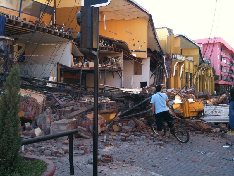
In mere minutes, the earthquake unleashed immense energy, causing widespread devastation across central and southern Chile. Buildings, bridges, and infrastructure were severely damaged or destroyed, underscoring the challenge of constructing edifices that can withstand such formidable forces. Coastal towns were particularly hard hit, with the quake’s tremors causing extensive damage to residences, public buildings, and vital utilities.
However, the earthquake’s impacts did not end with the shaking. It also triggered a powerful tsunami, which swept across the Pacific Ocean, affecting coastal communities far from the quake’s epicenter. In Chile, the tsunami waves compounded the destruction, washing away buildings and infrastructure, and leading to a tragic loss of life. The tsunami alert system, which had been expected to provide a warning, faced critical scrutiny in its aftermath, leading to significant improvements in both the technology and protocols for tsunami detection and response.
The 2010 Maule earthquake was a catalyst for significant scientific research, contributing valuable data to the study of seismology and tsunami genesis. It offered a stark illustration of the challenges of predicting the timing and impact of such events, despite advances in seismic monitoring and analysis. The quake’s occurrence along a well-known subduction zone provided crucial insights into the mechanisms of megathrust earthquakes, including how stress is accumulated and released along fault lines.
In the wake of the disaster, Chile embarked on a comprehensive effort to rebuild and enhance its resilience to future seismic events. This included revising building codes to enforce stricter construction standards, improving emergency response systems, and increasing public awareness and preparedness for natural disasters. The global community, too, has benefited from the lessons learned from the Maule earthquake, applying these insights to earthquake-prone regions worldwide.
5- Kamchatka, Russia, 1952: Magnitude 9.0
The 1952 earthquake in Kamchatka, Russia, represents a pivotal moment in the history of seismology and our understanding of the Earth’s dynamic forces. Occurring on November 4, 1952, with a magnitude of 9.0, this colossal seismic event is one of the highest-magnitude earthquakes ever recorded. Its occurrence in the remote Kamchatka Peninsula provided a unique study case for scientists and researchers, offering insights into the behaviors of seismic activities in subduction zones.
Kamchatka, a rugged and sparsely populated region, lies at the eastern edge of Russia, where the Pacific Plate subducts under the North American Plate. This subduction zone is known for its significant seismic activity, making the region a hotbed for earthquakes and volcanic eruptions. The 1952 earthquake originated deep within this subduction zone, releasing a tremendous amount of energy that was felt across vast distances.
The impact of the earthquake on the Kamchatka Peninsula itself was profound. Despite the area’s low population density, the seismic event caused considerable geological changes, including landslides, ground fissures, and significant alterations to the landscape. However, it was the tsunami generated by the earthquake that had far-reaching effects beyond the immediate vicinity. The tsunami waves radiated across the Pacific Ocean, causing damage as far away as Hawaii, Japan, and the West Coast of the United States. In some locations, these waves reached heights of up to 15 meters, demonstrating the immense power of seismic events to affect global coastlines.
The 1952 Kamchatka earthquake was instrumental in advancing our understanding of the mechanisms behind subduction zone earthquakes and the tsunamis they can generate. It highlighted the global interconnectedness of seismic events, underscoring the need for an international approach to earthquake monitoring and tsunami warning systems. This event contributed to the establishment of the Pacific Tsunami Warning Center, an important step in international efforts to mitigate the impact of such natural disasters.
4 – Tohoku, Japan, 2011: Magnitude 9.1
The Tohoku earthquake, which struck off the coast of Japan on March 11, 2011, is a defining moment in the history of natural disasters, a stark reminder of the Earth’s formidable power and the vulnerability of human societies to its whims. With a magnitude of 9.1, it ranks among the most powerful earthquakes ever recorded, unleashing a series of catastrophic events that would leave a profound and lasting impact on Japan and the world.
The earthquake occurred in the Pacific Ocean, approximately 70 kilometers east of the Oshika Peninsula of Tohoku, at a depth of about 30 kilometers. This region, where the Pacific Plate subducts beneath the North American Plate, is known for its seismic activity, but the magnitude of the Tohoku earthquake took even the most experienced geologists by surprise.
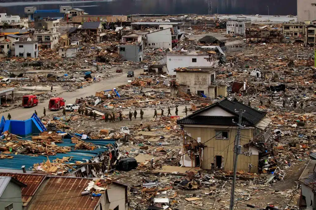
The immediate effects of the earthquake were devastating. Strong ground shaking caused widespread damage across northern Japan, including the collapse of buildings, roads, and bridges. Infrastructure critical to the region’s livelihood was severely impacted, disrupting utilities and communications. The damage was not confined to the epicentral area; tremors were felt as far away as Tokyo, hundreds of kilometers from the quake’s epicenter, illustrating the immense energy released by the seismic event.
However, it was the tsunami triggered by the earthquake that led to the most dire consequences. Towering waves, some reaching heights of up to 40 meters, inundated coastal areas minutes after the initial quake, overwhelming sea defenses and washing away everything in their path. Entire communities were obliterated, and thousands of lives were lost in the immediate aftermath. The tsunami’s force carried ships inland, crushed buildings, and left vast areas under water, leading to a humanitarian crisis of immense proportions.
Among the most alarming outcomes of the disaster was the crisis at the Fukushima Daiichi Nuclear Power Plant, where the tsunami’s impact led to a series of equipment failures, nuclear meltdowns, and releases of radioactive materials. This added a complex layer to the disaster relief efforts, necessitating the evacuation of tens of thousands of residents from the surrounding area and sparking a global reconsideration of the safety of nuclear energy.
The Tohoku earthquake and its aftermath revealed the challenges of preparing for and responding to extreme natural events. Despite Japan’s advanced earthquake readiness and stringent building codes, the sheer scale of the disaster overwhelmed existing defenses. In the wake of the tragedy, Japan and the international community have sought to learn from the events of March 11, investing in improved earthquake and tsunami warning systems, reevaluating safety protocols for critical infrastructure, and enhancing community resilience practices.
3 – Sumatra, Indonesia, 2004: Magnitude 9.1
The 2004 Sumatra earthquake, occurring on December 26, stands as one of the most devastating natural disasters in recent history. With a magnitude of 9.1-9.3, it is among the largest earthquakes ever recorded. This seismic event off the west coast of northern Sumatra, Indonesia, unleashed an unprecedented global catastrophe, primarily through the massive tsunamis it triggered, impacting countries around the Indian Ocean and beyond.
The earthquake was caused by the subduction of the Indian Plate beneath the Burma Plate, a powerful tectonic activity that released a tremendous amount of energy over a vast area. The rupture was more than 1,500 kilometers long, displacing the seabed by several meters and sending shockwaves across the globe.
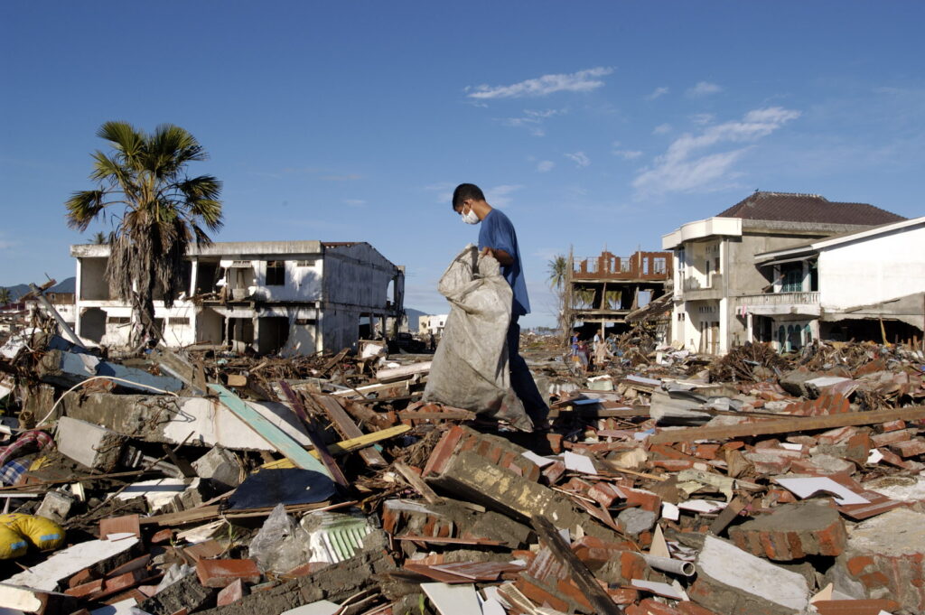
The immediate aftermath in the region was catastrophic. The force of the earthquake itself caused significant damage to structures in northern Sumatra, including the province of Aceh, where buildings collapsed, and infrastructure was severely damaged. The quake’s power was such that it was felt as far away as Thailand, India, and even parts of Africa.
However, the most destructive aspect of this disaster was the series of tsunamis generated by the seismic event. Within minutes of the earthquake, towering waves, reaching heights of up to 30 meters in some areas, struck the coasts of Indonesia, Thailand, Sri Lanka, India, and as far as the Maldives, Somalia, and other countries bordering the Indian Ocean. The tsunamis swept away entire communities, causing widespread destruction and resulting in over 230,000 deaths, making it one of the deadliest natural disasters in recorded history.
The tsunamis obliterated coastal zones, erasing villages and towns from the map, and leaving millions homeless. The destruction of infrastructure complicated immediate rescue efforts and significantly delayed the arrival of international aid. The disaster exposed vulnerabilities in disaster preparedness and response, particularly in tsunami warning systems, which were virtually non-existent in the Indian Ocean region at the time.
The aftermath of the earthquake and tsunamis sparked a global humanitarian response, with countries around the world sending aid and volunteers to assist in the recovery and rebuilding efforts. The disaster also led to the establishment of the Indian Ocean Tsunami Warning and Mitigation System, aiming to prevent such a tragedy from happening again.
In the years following the 2004 Sumatra earthquake, much has been learned about the importance of coastal resilience, the need for effective early warning systems, and the power of international cooperation in the face of natural disasters. This event has profoundly influenced policies and practices related to disaster risk reduction, emphasizing the need for preparedness, rapid response, and sustainable reconstruction strategies that prioritize the safety and well-being of vulnerable communities.
2 – Prince William Sound, Alaska, 1964: Magnitude 9.2
The 1964 Prince William Sound earthquake in Alaska, occurring on March 27, is etched in history as the most powerful earthquake in North American history and the second largest ever recorded worldwide, with a staggering magnitude of 9.2. This monumental seismic event, also known as the Good Friday Earthquake, struck with such force that it reshaped the Earth’s surface, led to significant geological discoveries, and profoundly influenced disaster preparedness policies.
The earthquake’s epicenter was located in Prince William Sound, but its impact radiated far beyond, affecting around 130,000 square miles of Alaska. The quake lasted approximately 4.5 minutes—a duration that allowed it to cause extensive damage across southern Alaska, including the Anchorage area, which was particularly hard hit.
The immediate aftermath was catastrophic. Ground fissures, collapsing structures, and landslides were widespread, leading to considerable property damage and the tragic loss of 131 lives. One of the most dramatic effects was observed in the town of Valdez, where a massive underwater landslide triggered a devastating tsunami, engulfing the waterfront and claiming many lives.
The seismic event caused significant vertical displacement along faults, with some areas near the epicenter rising by as much as 11 meters, while others sank by 2.3 meters. This led to the submersion of coastal areas and the creation of ghost forests—stands of trees that died after being submerged by salt water.
Beyond the immediate physical damage, the 1964 earthquake had a profound impact on the scientific community. It provided invaluable insights into the mechanics of subduction zone earthquakes and tsunamis, contributing to the development of the theory of plate tectonics. Researchers were able to study the quake’s effects on the Earth’s crust and gain a better understanding of seismic risks, which has informed earthquake preparedness efforts worldwide.
In the wake of the disaster, there was a significant push to improve building codes and construction practices in seismic zones, not only in Alaska but also in other vulnerable regions. The earthquake underscored the need for stringent building standards that could withstand seismic forces, leading to safer infrastructure and reduced risk to human life.
The disaster also highlighted the importance of effective emergency response and community preparedness in minimizing the impact of such catastrophic events. It led to the establishment of the Alaska Tsunami Warning Center (now part of the National Tsunami Warning Center) and the implementation of more sophisticated seismic monitoring systems, enhancing the ability to provide timely warnings for future seismic events.
1 – Valdivia, Chile, 1960: Magnitude 9.5
The 1960 Valdivia earthquake in Chile, occurring on May 22, holds the distinction of being the most powerful earthquake ever recorded, with a magnitude of 9.5. This seismic event, also known as the Great Chilean Earthquake, unleashed a series of catastrophic events that left an indelible mark on the country and the world’s understanding of natural disasters.
Centered near the city of Valdivia, the earthquake’s immense power was felt over a vast area, with impacts extending as far as the United States, Japan, the Philippines, and New Zealand. The quake itself, which lasted for approximately 10 minutes, caused widespread destruction across southern Chile. Buildings crumbled, roads were rendered impassable, and bridges collapsed, isolating many communities and complicating rescue and relief efforts.
One of the most harrowing consequences of the Valdivia earthquake was the tsunamis it triggered, both locally and across the Pacific Ocean. In Chile, the tsunami waves reached heights of up to 25 meters, obliterating coastal towns and claiming thousands of lives. The tsunamis traveled across the Pacific, causing damage and loss of life as far away as Hawaii, Japan, and the Philippines, underscoring the global reach of the disaster.
In addition to the tsunamis, the earthquake caused other significant geological phenomena, including landslides and the formation of fissures. One notable effect was the subsidence of large areas of land, leading to the permanent flooding of portions of the Chilean coast and the creation of new lakes.
The aftermath of the earthquake revealed the vulnerability of human societies to nature’s might. The disaster prompted a reevaluation of preparedness and response strategies, not only in Chile but around the world. It highlighted the importance of building codes designed to withstand seismic forces and the need for effective national and international mechanisms to provide timely warnings and coordinate disaster response efforts.
The Valdivia earthquake also had a profound impact on the scientific community. It provided critical data that contributed to the development of the theory of plate tectonics, offering insights into the forces that drive seismic activity. The event spurred advancements in seismology and earthquake engineering, leading to better understanding and mitigation of the risks posed by such powerful natural events.
The resilience of the Chilean people in the face of such adversity was remarkable. The reconstruction efforts that followed not only aimed to rebuild what was lost but also to create a society better prepared for future seismic events. This approach has informed Chile’s disaster management policies to this day, emphasizing not only physical rebuilding but also community preparedness and psychological support for those affected.


